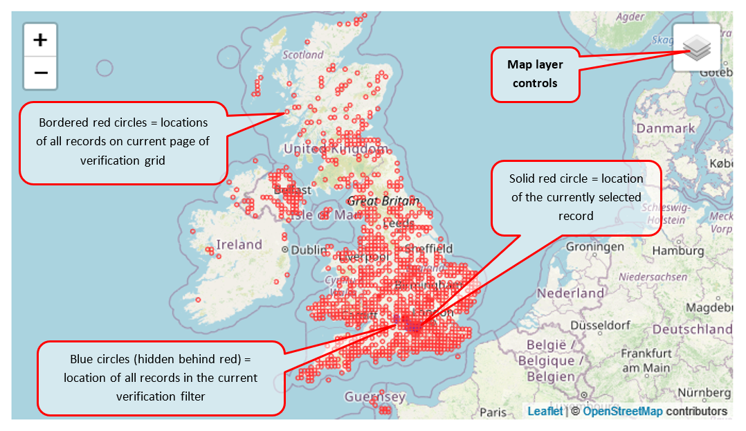
The map is provided to give some context to the record and allow you to check whether the location seems to be correctly recorded. There are some map settings that allow you control the layers that appear on the map; the default view shows:
If you put your mouse over the “Map layer controls” box it will open up and show you some tick-box options:
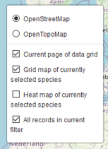
The four options for the symbols that get plotted onto the map are:
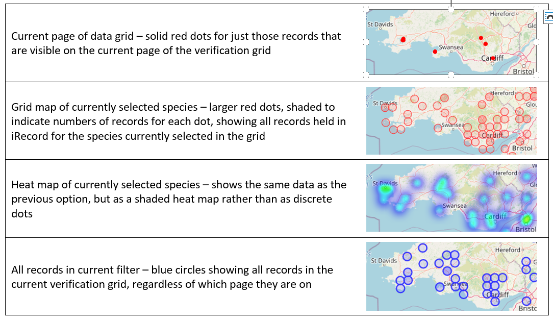
As always it is worth trying out these options to see what works best for you. (The one that I use most frequently is “Grid map of currently selected species”, which allows me to quickly see whether the record I am dealing with falls within the known range of the species.)